Why LiDAR Mapping Is Changing Construction
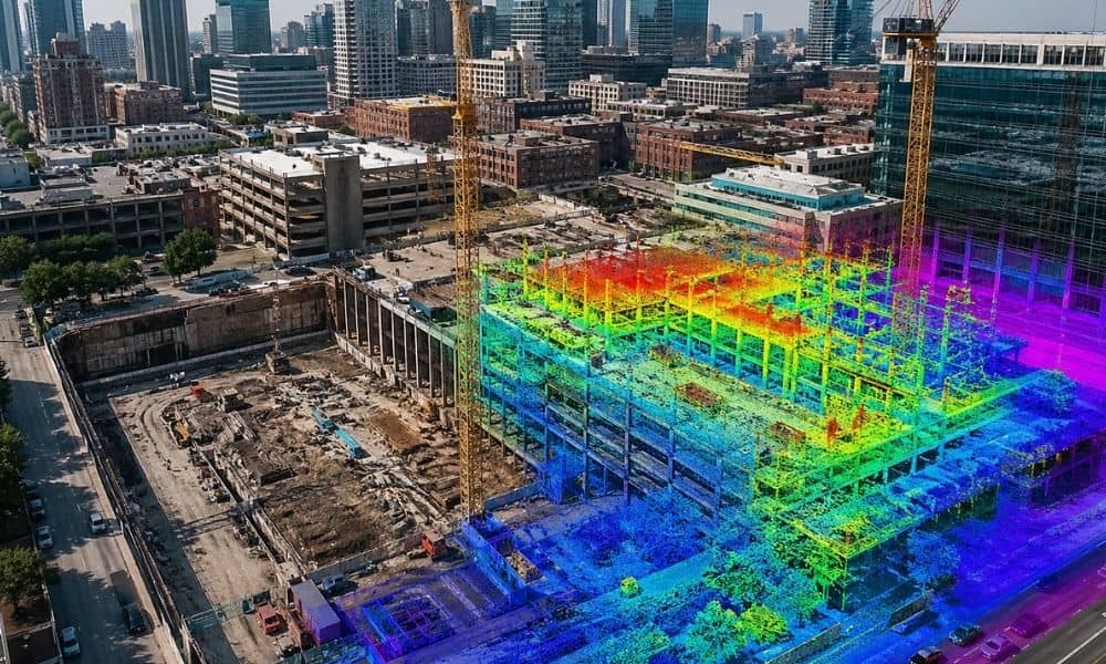
Downtown Nashville keeps changing fast. New buildings rise next to older structures, often on tight or fully developed lots. Roads stay busy, and construction crews work in limited space with very little room for error. On crowded sites, even small mistakes can slow an entire project or lead to expensive rework later. A missed level […]