

If you are buying or financing property, you may have heard of an ALTA survey. It plays an important role in many commercial real estate deals. Recently, something changed. In 2026, new national standards for ALTA surveys took effect.
These updates may sound technical. However, they can affect how property deals move forward.
For buyers, developers, and lenders, the changes mean surveys may include more research and clearer records. As a result, property information becomes easier to understand. These updates can also help prevent confusion during a closing.
Why ALTA Survey Standards Change Over Time
An ALTA survey follows national standards created by the American Land Title Association and the National Society of Professional Surveyors. These standards guide surveyors across the country. Every few years, these organizations review the rules. Then they update them.
Why does this happen?
Property deals become more complex over time. Cities grow. Land gets divided. Land gets developed. It also gets sold many times. Because of this, survey standards must change. Surveyors need clear rules so they can record land correctly.
The 2026 update aims to make property records clearer. It also helps lenders, attorneys, and title companies rely on the same survey information during real estate deals.
For a fast-growing city like Nashville, these improvements matter. The market moves quickly. Clear property information helps keep deals moving forward.
What Changed in the 2026 ALTA Survey Standards
The 2026 revisions focus on how surveyors research and record property information. The purpose of the survey did not change. Instead, the updates improve how surveyors collect and show data.
One change involves deeper record research. Surveyors now review more documents related to the property. They may also review nearby parcels. This step helps confirm that boundary lines match existing records.
Another update highlights the need to review neighboring properties. When surveyors check nearby parcels carefully, they can find possible gaps or overlaps sooner.
The standards also explain more clearly how certain optional items should appear in a survey. These options are called Table A items. Lenders or clients often request them. These items provide extra details about the property.
Together, these changes help create clearer survey reports. They also reduce questions during property deals.
How the New Standards Affect Survey Preparation
Because of the new rules, survey preparation may involve more detailed research. Surveyors now spend more time reviewing records before field work begins.
They study property deeds. They review legal descriptions. They also check public records. After that, they collect measurements on the property.
Next, surveyors compare their field measurements with legal records. This step helps confirm that the boundaries match both the documents and the land.
Surveyors may also review nearby parcels more closely. This helps confirm that property lines align with surrounding land records.
These steps require careful work. However, they improve the accuracy of the final survey.
What Clients May Notice in Future ALTA Surveys
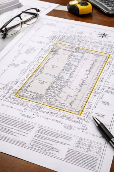
If you review an ALTA survey completed under the new standards, you may notice a few changes.
First, the survey drawing may include more detailed notes. These notes often refer to documents used during research. Examples include deeds and recorded plats.
Second, the survey may show clearer links between property lines and nearby parcels. Surveyors may explain how a boundary connects to neighboring land records.
Third, field observations may appear more precise. Surveyors often record fences, buildings, or other visible improvements near property lines.
These details may seem small. However, they improve clarity. Everyone reviewing the survey can better understand the property boundaries.
Preparing for an ALTA Survey Under the New Standards
Because the standards changed, coordination during a property deal becomes more important. Buyers, developers, and lenders can help the process move smoothly. Many teams begin gathering key documents early in the due diligence period, often around the same time they order an ALTA survey for the property.
One important document is the title commitment. This document lists legal details about the property. It may include easements and restrictions. Surveyors use this information during their research.
Lenders or title companies may also choose certain Table A items. These optional features decide what extra details the survey will include.
Providing copies of older plats or previous surveys can also help. These records often show how the land changed over time.
With the right documents ready, surveyors can complete the work more smoothly while meeting the updated standards.
Why the Updated Rules Improve Property Due Diligence
The 2026 standards aim to make property information clearer and more reliable. This improvement helps several groups involved in a real estate deal.
For example, lenders rely on accurate land information before approving financing. Clearer survey records help them review risk more easily.
Attorneys and title companies also benefit. When surveys show property boundaries clearly, title professionals can review records with fewer questions.
Developers and investors gain advantages as well. Reliable land information helps them understand property limits before making financial decisions.
In short, the updated rules improve the due diligence process. The changes require careful work from surveyors. However, they support smoother property deals.
Why Local Survey Experience Still Matters
ALTA survey standards apply across the country. However, local knowledge still matters.
Every region has unique land records. Development patterns differ. Property history can also vary.
In Nashville, rapid growth has changed many areas in recent years. New developments often sit beside older parcels with long histories.
Because of this, surveyors must understand both modern standards and local land records.
A licensed land surveyor can handle these challenges more effectively. Local experience helps ensure that surveys meet national standards while matching local conditions.
Final Thoughts
The 2026 updates to national survey standards mark an important step forward for property records.
The changes focus on technical details. However, they bring real benefits to property deals.
For buyers, lenders, and developers, the updated rules mean clearer land records and stronger due diligence.
An ALTA survey prepared under the new standards provides a clearer view of a property’s legal boundaries and supporting records.
As Nashville continues to grow, accurate property information becomes even more important.
Working with a qualified surveyor who understands the updated standards can help keep your property deal moving forward with confidence, especially when working with professionals who stay closely aligned with the latest requirements, such as ALTA Land Survey.