
Nashville is growing fast, and with that growth comes new rules about how land can be used. Recently, Metro Planning introduced two new zoning categories — Residential Neighborhood (RN) and Residential Limited (RL). These changes are designed to allow more housing options, like duplexes, townhomes, and cottage courts, while still keeping neighborhood character in mind. Exciting news, right? But here’s the part many homeowners and builders overlook: before you can take advantage of these zoning updates, you’ll need a property survey. Without it, you’re making guesses about your land, and guesses don’t get approved by Metro Council or Codes.
What the RN and RL Zoning Categories Mean
If you live in Nashville, you’ve probably seen the tension between old bungalows and new builds. The RN and RL zoning categories are an attempt to bring balance.
- RN zoning: Opens the door for more housing density. It allows duplexes, townhomes, and even cottage courts in some areas. That means one piece of land might host more than a single home, provided it meets requirements.
- RL zoning: Still encourages growth but at a smaller scale. Think of it as a way to introduce more homes without overwhelming existing streets.
On paper, these changes look like opportunity. But zoning laws don’t redraw your lot lines. They don’t magically tell you how wide your lot really is or whether it can handle a new build. That’s where a property survey comes in.
Why a Property Survey Is the Starting Point
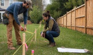
A property survey isn’t just about knowing where your fence belongs. It’s a legal map that shows the true boundaries, dimensions, and features of your land. When Metro Council considers a rezoning request, or when Codes reviews a permit, the first question they ask is: What does the survey say?
Here’s why:
- Setbacks and street context: Nashville uses “contextual setbacks” for many permits. That means the distance from the street to your front wall is based on the average of your neighbors’ homes. A property survey shows exactly where your house sits compared to the rest.
- Lot splits and density checks: If you want to divide your lot for a duplex or cottage court, you’ll need proof that the new lots meet the required width and depth. A survey provides that proof.
- Access and alleys: Many infill projects depend on alleys for parking and driveways. A survey identifies whether you even have alley access.
- Easements and utilities: You may think your entire yard is fair game, but drainage or utility easements could limit where you can build. Surveys bring these hidden details to light.
Without a property survey, you’re relying on assumptions. And in development, assumptions often lead to delays, redesigns, or even permit denials.
How Zoning and Surveys Work Together
Think of zoning as the rulebook and a property survey as the playbook. The rules say what’s possible, but the survey shows what’s real on the ground.
For example:
- A homeowner in East Nashville might dream of adding a duplex. The zoning code allows it, but the survey shows the lot is two feet too narrow. Without that survey, the project could stall halfway through planning.
- A builder in Donelson might want to create a small cluster of cottages. A property survey would confirm setbacks, easements, and topography before they invest in full design plans.
- A family in 12South might be eyeing a split. Their survey could prove the frontage is enough for two legal parcels.
In each case, the survey is the reality check that saves time, money, and stress.
Why Acting Early Makes a Difference
Some people wait until they’re knee-deep in design work before calling a surveyor. That’s a mistake. By then, you’ve spent money on plans that might not work.
Getting a property survey early has three big advantages:
- Clarity with Metro: When you walk into a planning office with a stamped survey in hand, you show you’re serious. Staff can give you clearer guidance because they’re looking at the same map you are.
- Fewer surprises: Surveys uncover issues before they become problems — whether it’s a narrow frontage, an unrecorded easement, or a slope that complicates drainage.
- Speed: Nashville is competitive. Builders who already have surveys ready can move faster when opportunities arise. That’s especially important as zoning categories evolve.
What to Expect in a Zoning-Focused Property Survey
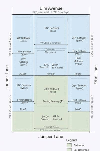
A good survey for RN or RL zoning projects includes more than just property lines. It may also show:
- Setback measurements from the front, side, and rear.
- Lot coverage calculations, which show how much of the land can be built on.
- Access points, including alleys and driveways.
- Recorded easements for utilities or stormwater.
- Topography, if slope or drainage affects your build.
This information becomes the backbone of your rezoning application, construction drawings, and even lender approval if financing is involved.
A Changing City Needs Solid Ground
Nashville isn’t slowing down. New zoning categories like RN and RL are meant to guide growth, but they also create more complexity for property owners. The last thing you want is to spend months dreaming about a project, only to find out it doesn’t fit your lot.
A property survey doesn’t just protect you from mistakes. It gives you confidence that your plans align with both your land and the city’s rules.
Final Thoughts
The RN and RL zoning updates are a chance for Nashville to grow smarter, with more housing choices for families, students, and first-time buyers. But opportunity only turns into results when you start with facts.
And the fact is simple: if you’re building, splitting, or rezoning, a property survey is your first step. It turns uncertainty into clarity, risk into preparation, and dreams into projects that can actually break ground.
So, before you draw up floor plans or call a contractor, make sure you have that survey in hand. In a city that’s changing as fast as Nashville, it might be the most important investment you make.