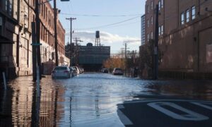
If you live in Nashville, you’ve probably seen the recent flood updates. A new report shows that one in twenty homes across the city may now be at risk of flooding. For many homeowners, that’s a surprise. Neighborhoods that were once considered safe are now part of newly drawn flood zones. When something like this happens, insurance rates often change too. But there’s one document that can help you prove your property’s true flood risk—and possibly save you money. It’s called a flood elevation certificate, and it can make the difference between paying a fair insurance rate and paying too much.
Understanding the Flood Elevation Certificate
A flood elevation certificate (FEC) is a document prepared by a licensed land surveyor. It measures how high your home’s foundation sits compared to the base flood elevation—the level FEMA uses to decide if a property is in a flood zone.
Think of it like your home’s “height report.” It shows insurance companies whether your lowest floor is above or below the flood-risk line. The higher your home sits above that line, the lower your risk and, often, the lower your flood insurance premium.
Without this certificate, insurers sometimes assume the worst. They may classify your property as high-risk based only on your area or ZIP code. That’s why getting a certified flood elevation certificate is so important—especially when flood maps change.
What Changed in Nashville
Floodplain boundaries across the city have shifted. Updated data on rainfall, storm drainage, and urban growth revealed that certain areas are more vulnerable than before.
Even small changes in elevation can move a property from “low” to “high” risk. Homes near creeks, retention ponds, or newly developed land are especially affected. Some homeowners who never worried about floods before are now finding themselves inside the risk zone for the first time.
That’s why verifying your property’s exact elevation matters. A flood elevation certificate provides hard evidence of where your home truly stands relative to the floodplain.
How to Check If Your Home Was Affected
You don’t need to wait for a notice from your insurance company. You can check your flood zone status online using public map tools. Search your address on FEMA’s flood map or use your local parcel viewer to see whether your home falls within a colored flood-risk area.
If your property touches or overlaps a flood zone boundary, it’s time to get expert confirmation. A licensed land surveyor can measure your property’s exact elevation and prepare a flood elevation certificate that’s accepted by insurance companies and lenders.
When a Flood Elevation Certificate Can Save You Money
Suppose your home’s foundation sits higher than the mapped flood level. That’s great news—but unless you can prove it, your insurance company won’t know.
With a certified flood elevation certificate, you can show that your home is above the base flood elevation. Many homeowners have reduced or even removed costly flood-risk surcharges by providing updated certificates.
In some cases, you can take it a step further. If the survey shows that your property is clearly above the flood zone, you can apply for a Letter of Map Amendment (LOMA) to remove your home from the high-risk designation entirely. That not only lowers insurance costs but also adds value when you sell your home.
And if your home truly is below the flood level? The certificate still helps. It tells you what improvements—like raising utilities or adding vents—can reduce future risk.
What Surveyors Measure

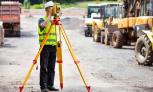
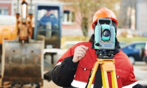
A surveyor gathers detailed elevation data using precision tools. Here’s what they look at:
- Lowest Adjacent Grade (LAG): The lowest point where the ground touches your home.
- Finished Floor Elevation (FFE): The height of your first livable floor.
- Base Flood Elevation (BFE): The height FEMA predicts floodwaters could reach in a major storm.
- Benchmark and Datum: Reference points that ensure all measurements match federal standards.
Surveyors may use GPS or drone technology for accuracy, but a licensed land surveyor must still sign and certify the results before they’re valid for insurance or FEMA use.
How to Read Your Certificate
A flood elevation certificate can look technical, but it’s easier to read once you know what to look for:
- Section A: Basic property details like address and structure type.
- Section B: Flood map information, including the community and panel number.
- Section C: Elevation data—this is the part insurers rely on.
- Section D: The surveyor’s certification and license number.
Check that your certificate uses the NAVD88 vertical datum, which is the standard for Tennessee. Using outdated data references can cause confusion or rejections from insurers.
If you see something that doesn’t look right, ask your surveyor to explain. Small errors can delay approvals or insurance discounts.
Why It’s Smart to Act Now
Flood maps don’t stay static. Each update adds or removes properties based on new data. Once insurance companies adopt the latest version, they’ll base rates on those changes—whether they’re right or not.
Getting your flood elevation certificate now means you’ll already have verified data when those updates take effect. You’ll be ready to challenge errors, apply for discounts, or request map amendments before renewal season arrives.
Nashville’s landscape is constantly changing, with more paved surfaces and faster stormwater runoff. That makes flood risks harder to predict. Having an up-to-date certificate protects you not just from rising premiums but also from surprise reclassifications in the future.
Final Thoughts
Flood risks can shift quietly, but being prepared is simple. Flood elevation certificates are more than pieces of paper—they’re proof of your property’s real safety and value.
Before renewal season or the next big storm, check your address on the flood map. If your property lies within or near a risk zone, reach out to a licensed land surveyor to get your certificate done.
A few accurate measurements today can save you thousands tomorrow—and give you peace of mind that your home’s protection isn’t based on guesswork.


