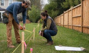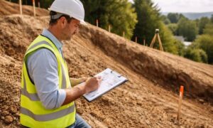
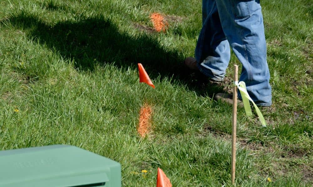
You finally did it. After searching for a land surveyor near me, making a few calls, and waiting for the appointment, the crew arrived, measured your property, and placed flags and stakes around your yard. At first, everything looked clear. Then a new worry started creeping in.
What if the flags blow away? What if someone moves a stake? What if your fence contractor can’t find the markings later?
If this sounds familiar, you’re not alone. Many homeowners feel stressed after a survey, especially when they don’t fully understand what the markings mean or how long they last. The good news is that protecting your survey results is easier than you might think. With a little knowledge and a few smart steps, you can avoid mistakes, reduce stress, and keep your property lines accurate.
Why Survey Markings Don’t Last Forever
First, it helps to understand why survey markings look temporary. Those bright flags, painted lines, and wooden stakes exist mainly as visual guides. They show where important points are located, such as corners, boundaries, and construction layout lines.
However, surveyors do not rely on flags alone. They place or locate permanent reference points, often metal rods or monuments, that define the true legal boundaries of your land. The visible markings simply help homeowners, builders, and inspectors see where those points are located.
Because of this, flags can fade, paint can wash away, and wooden stakes can get knocked over. Rain, lawn mowing, pets, kids, and foot traffic all take a toll. Even wind alone can remove half your markings in a single afternoon.
That does not mean your survey is ruined. It simply means the visible part of the survey needs some attention if you want to keep things clear.
Why Homeowners Worry After a Survey
Many homeowners feel a sense of panic once the survey crew leaves. The markings look fragile, and the fear of losing them starts to build. Some worry they might need to pay for another full survey if the flags disappear.
That concern shows up often in homeowner discussions online. People post about fading paint, missing stakes, and contractors arriving weeks later with no visible layout left. Thankfully, survey data does not disappear just because the markings fade.
The legal measurements still exist in the survey records. However, protecting the visible markers makes the next steps much smoother, especially if construction, fencing, or landscaping work is planned.
The Biggest Mistake People Make After Hiring a Surveyor
One of the most common mistakes homeowners make is trying to place their own permanent markers. Many assume that installing rebar or metal stakes will help preserve the survey. Unfortunately, this often leads to confusion and costly errors.
Without professional equipment and training, it becomes nearly impossible to position those markers accurately. Even a few inches of error can lead to disputes, construction delays, or legal problems.
Instead of adding new markers, homeowners should focus on documenting existing ones. This approach protects the survey without risking inaccurate placement.
How to Protect Your Survey Markings the Right Way

Protecting your survey results does not require special tools or technical knowledge. A few simple steps can go a long way.
Start by taking clear photos of each stake, flag, and corner marker. Capture wide shots that include nearby features such as house corners, sidewalks, trees, fences, and driveways. These reference points make it easier to relocate markings later.
Next, measure distances from survey points to permanent objects. For example, record how far a stake sits from the corner of your home or from the edge of your driveway. Write these numbers down and store them with your survey documents.
You can also place visible temporary markers, such as brightly colored wooden stakes or plastic caps, near the original points. These help maintain visibility without creating false permanent boundaries.
Finally, keep copies of your survey plat both digitally and in print. If markings fade, surveyors can quickly restore them using this data instead of repeating the entire process.
How Long Survey Markings Stay Reliable
Survey data does not expire, but property conditions change. Soil shifts. Landscaping alters the terrain. Construction activity disturbs the ground. Over time, these changes affect how clearly survey points remain visible.
If you plan to start your project soon, the original markings should work well. However, if months pass or major site work occurs, it often makes sense to request a quick remarking visit.
This small step ensures continued accuracy and often costs far less than a full resurvey.
When You Should Call a Land Surveyor Again
Sometimes, calling a land surveyor again becomes the smartest move. Certain projects demand high accuracy and professional confirmation.
These situations include fence installations, driveway paving, home additions, garages, decks, sheds, and property sales. Boundary disputes with neighbors also call for professional verification.
In these cases, refreshed staking prevents costly construction errors and protects everyone involved. A short follow-up visit often saves thousands of dollars in corrections.
Why Accurate Markings Matter More in Growing Cities
In rapidly growing areas, accurate property boundaries matter more than ever. Older neighborhoods often contain irregular lot layouts, outdated plats, and missing monuments. At the same time, new construction brings tighter zoning rules and strict inspections.
These conditions increase the risk of layout errors. Even small mistakes can cause setbacks, disputes, and permit issues. Proper survey documentation helps prevent these problems and keeps projects moving smoothly.
By protecting your survey markings, you maintain clarity, reduce stress, and support better project outcomes.
Confidence Comes From Understanding the Process
Much of the anxiety homeowners feel after hiring a surveyor comes from uncertainty. Once you understand how surveys work and what the markings represent, that stress fades.
Instead of worrying about missing flags, you gain confidence in your property layout. Instead of guessing, you rely on verified measurements. Instead of reacting to problems, you stay ahead of them.
That peace of mind alone makes the survey investment worthwhile.
Final Thoughts
Hiring a land surveyor marks an important step in protecting your property. However, the process does not end when the crew leaves your yard. Knowing how to protect your survey markings ensures that your project stays on track and avoids unnecessary complications.
So if you recently searched for a land surveyor near me, scheduled the service, and invested in accurate measurements, make sure your effort pays off. A little preparation today prevents frustration tomorrow.
When questions come up, reaching out to a licensed professional helps keep your project clear, accurate, and stress-free.