
Nashville keeps growing. New roads, safety upgrades, and public projects appear across the city every year. While most people notice what gets built, fewer notice how these projects get planned. Behind the scenes, better land data now guides many public decisions. That change sends a clear message to private developers, engineers, and property owners across Tennessee. LiDAR mapping plays a quiet but important role in this shift. Recent infrastructure and safety projects show that accurate land data is no longer optional. Instead, it sets expectations that affect private development across the region.
Public Projects Often Lead the Way
Public infrastructure projects usually move faster than new rules. Cities test new methods on roads, safety work, and flood projects before those methods become official standards.
In and around Nashville, recent safety and infrastructure efforts rely on detailed land and elevation data. These projects must clearly explain design choices. Because of that, planners use high-quality mapping to show slopes, drainage paths, and ground conditions.
As a result, public agencies now expect better site data. Private projects that follow these public efforts often face the same questions during review. This is where LiDAR mapping starts to matter.
Transportation Safety Projects Raise the Bar
Road safety projects need more than basic measurements. Engineers must understand how cars, people, and water move across real land. Even small changes in elevation can affect visibility, drainage, and traffic flow.
When cities study dangerous intersections or redesign busy roads, they rely on accurate ground models. This level of detail helps them predict problems before construction begins. It also lowers risk after the project opens.
For nearby private projects, this creates a ripple effect. Developments near major roads now face closer review. Agencies expect site data that matches what they use on public projects. If a site relies on older maps, reviewers may ask for changes.
Because of this, LiDAR mapping helps private projects meet current standards.
Flood and Stormwater Planning Demand Better Elevation Data
Flood risk remains a serious concern across Middle Tennessee. Heavy rain happens more often, and storm systems feel the pressure. Public agencies must clearly support their drainage and flood decisions.
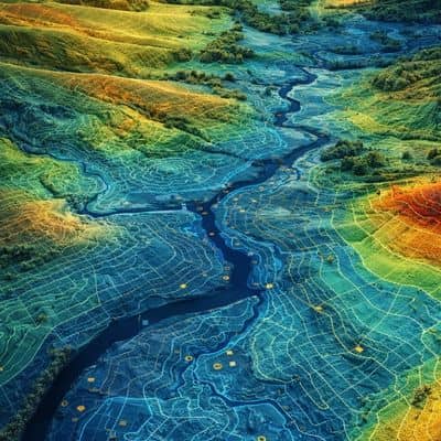
Recent flood projects depend on detailed elevation data to understand how water flows across land. Small changes in grade can make a big difference. Older maps often miss these details.
Because of this, reviewers now question assumptions more closely. Developers must back up drainage plans with solid land data. If the mapping lacks detail, approvals slow down.
LiDAR mapping creates clear elevation models that reduce guesswork. When engineers use accurate data, they can explain designs with confidence. That helps projects move forward without delays.
What These Signals Mean for Private Development
Public infrastructure projects show what reviewers expect today. They reveal where rough estimates no longer work. They also show how data quality affects approvals.
For private development, this means early choices matter more than ever. Using better site data at the start lowers risk later. It also helps engineers during plan review.
Projects that match public data standards usually move faster. Reviewers ask fewer questions. Engineers revise plans less often. Owners face fewer surprises during construction.
The Cost of Falling Behind
Projects that rely on outdated or limited mapping often run into problems later. These issues rarely show up right away. Instead, they tend to surface during plan review or once construction is already moving.
During permitting, reviewers may ask for more studies or clarifications. That slows timelines, adds cost, and forces design changes that could have been avoided earlier.
Construction creates even more pressure. Grades may not line up with the plans. Water may move differently than expected. Crews then have to adjust in the field, which costs far more than getting the site right from the start. For many teams, lidar mapping tennessee has become part of that early planning step, helping them see these issues before they turn into expensive fixes.
How Smart Projects Are Responding
Many developers now see high-quality mapping as part of planning, not an extra service. They use accurate data early to test ideas before final designs.
This approach improves teamwork between surveyors, engineers, and designers. Everyone works from the same reliable base. As a result, plans better match real site conditions.
Early clarity also helps with budgeting. When teams understand slopes and drainage early, cost estimates become more accurate. That reduces risk as projects move forward.
LiDAR Mapping Is Becoming the New Normal
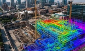
LiDAR mapping no longer sits on the sidelines. In many cases, it forms the base for planning decisions. This change happens quietly, but its impact keeps growing.
Urban infill sites, large parcels, and land near infrastructure benefit the most. These sites are more complex and face closer review. Accurate mapping helps teams respond with confidence.
As public projects continue to raise expectations, private development follows. Those who adjust early gain a clear advantage.
What Developers Should Remember
Recent infrastructure and safety projects send a clear message. Better data leads to better decisions. Mapping expectations change before rules do.
Developers who notice these signals reduce risk. They avoid delays. They build with more confidence. Most importantly, they limit costly surprises.
LiDAR mapping helps teams prepare for this reality. It supports smarter planning today and keeps projects aligned with how development continues to evolve.