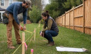

After the recent storms in Nashville, many homeowners started to notice something strange. Yards that used to stay dry now hold water. Driveways carry runoff like small streams. In some cases, water even moves toward the house instead of away from it. At first, this feels sudden. However, the truth is simple. The storm did not create the problem—it revealed it. When heavy rain hits, water follows the shape of your land. If the slope is off, even a little, problems show up fast. Because of this, many people rush to fix the issue right away. They add gravel, dig a trench, or call someone to regrade the yard. Still, those fixes often fail. Without understanding how your land actually works, you are only guessing. A topographic survey often brings that missing clarity. It shows how your land is shaped and how water actually moves across it, which is why it helps to start with getting a clear picture of your land before making changes instead of jumping straight into a fix.
When the Rain Stops, the Problems Stay
After a storm passes, the damage becomes easier to see. You may walk outside and notice puddles sitting in the same spots. The grass feels soggy for days. Water may collect near your foundation or along the edges of your driveway.
In Nashville, this happens more often than people expect. The area has rolling terrain, mixed soil, and fast-moving rain. Because of that, water does not always soak into the ground. Instead, it travels across the surface and settles in low areas.
Even if your yard looked fine before, the storm shows you how it really behaves. That is important. What you see after heavy rain is the true pattern of water flow on your property—and it’s often the kind of detail a topographic survey can reveal.
Why Most Fixes Don’t Last
When water becomes a problem, most homeowners try to solve it quickly. That makes sense. You want your yard to dry out and stay usable.
However, many of the common fixes do not last. Adding gravel may help for a short time, but water still collects underneath. Digging a small trench might move water away from one area, yet it often sends it somewhere else. Installing a drain without a clear plan can even trap water instead of removing it.
These solutions fail because they do not address the root problem. Water follows elevation, not surface changes. So if the slope of your land stays the same, the problem stays too.
Because of this, quick fixes often turn into repeated costs.
Why Regrading Without Data Can Backfire
Regrading seems like a stronger solution. You reshape the land so water flows in the right direction. However, without accurate information, regrading becomes risky.
Many contractors rely on what looks right. They adjust the soil based on sight and experience. While that can work in simple cases, it often falls short on more complex properties.
Even small changes in elevation can shift water flow in unexpected ways. You might push water away from your yard, but then it ends up near your foundation. Or you may solve one wet area while creating another.
In some cases, water even flows toward a neighbor’s property, which can lead to disputes.
Because of this, regrading without proper data can make the situation worse instead of better.
What a Topographic Survey Helps You See
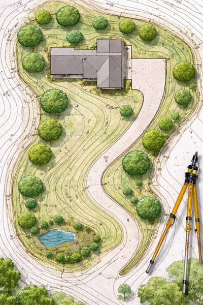
A topographic survey gives you a clear view of your land. It shows the exact shape of your property, including slopes, high points, and low areas.
More importantly, it shows how water moves across your land.
Instead of guessing, you can see where water starts, where it travels, and where it collects. You may discover a low spot you did not notice before. You might also find that a slope is not as steep as it looks, which explains why water is not draining.
This kind of insight changes everything. Once you understand the flow of water, you can plan a fix that actually works.
The Right Time to Take a Closer Look
After a storm is often the best time to step back and evaluate your property. The signs are clear, and the problem is easy to spot.
If water pools in your yard, if your driveway stays wet, or if you are planning to regrade, it makes sense to pause before taking action. The same applies if you want to install a patio, a retaining wall, or any feature that changes how your land drains.
At that point, a topographic survey becomes more than helpful—it becomes necessary. It gives you the information you need before you spend money on changes.
Why This Matters for Nashville Properties
Nashville is not a one-size-fits-all place when it comes to land. Some properties sit on gentle slopes, while others have sharp elevation changes. Even homes on the same street can behave very differently during a storm.
Because of that, copying what worked for someone else may not solve your problem. Each property has its own shape, its own drainage pattern, and its own challenges.
On top of that, storms in the area can bring heavy rain in a short time. That puts even more pressure on your yard’s ability to drain properly.
So understanding your land is not just helpful—it is essential.
Start with Understanding, Not Guessing
After seeing water problems, it is easy to act fast. You want to fix the issue and move on. However, without the right information, fast decisions often lead to repeat problems.
A topographic survey gives you that information. It helps you understand your property before you change it. Instead of guessing, you can make smart decisions based on real data.
In the end, the goal is simple. You want to solve the problem once and avoid dealing with it again. Starting with a clear understanding of your land is the best way to make that happen.