
So, you’ve got plans. Maybe you’re adding a fence, building a garage, or finally putting in that pool you’ve always wanted. Exciting stuff. But before you call the contractor or start marking the yard, there’s one thing you shouldn’t skip: a boundary line survey.
Property lines aren’t always as clear as you’d think. That old fence in the back? It doesn’t necessarily mark the true boundary. In fact, in places like Nashville, where older homes and brand-new builds sit side by side, lines can get pretty blurry. And nothing kills the excitement of a new project faster than finding out part of it was built on your neighbor’s lot.
What a Boundary Line Survey Really Is
Think of a boundary line survey as your property’s “fact check.” A licensed surveyor digs into the records, brings out some seriously precise equipment, and figures out exactly where your land begins and ends.
This isn’t just a quick sketch or the basic survey your bank ordered when you bought the place. It’s a detailed look at your lot’s edges and corners, backed up by history and science. The end result? You’ll have clear markers in the ground and a legal map that shows the shape and limits of your property.
In Nashville, property lines can get especially tricky. You’ll find tight city lots in East Nashville and broad suburban yards just a few miles away. That mix is exactly why homeowners often turn to a boundary survey; it gives them a clear picture of where their property begins and ends before they start building.
Why It Matters More Than You Think
Most people don’t think about surveys until there’s trouble. A neighbor complains about your fence. A buyer backs out because the lot isn’t what they thought. Or worse, you spend thousands on a project only to find out part of it needs to be torn down.
That’s the beauty of a boundary line survey — it keeps you one step ahead of those problems. Imagine putting in a new driveway, only to realize later that a few feet of it crosses onto the property next door. Suddenly you’re not just paving; you’re negotiating, paying lawyers, or redoing work. A survey saves you from that mess.
And it’s not just about construction. If you’re buying or selling, a recent survey makes the whole process smoother. Buyers like knowing exactly what they’re getting, and sellers can avoid ugly surprises at closing.
The Right Time to Get One
You don’t need a survey every time you hammer in a nail. But there are moments when it makes perfect sense. The obvious one is before you start any kind of construction. Even something simple, like a new fence or a small shed, can stir up trouble if it creeps past the line.
It’s also smart if you’re buying land, especially an empty lot. On paper, that property might look like a rectangle. In reality, the shape could be very different. The last thing you want is to discover that your dream build won’t fit because the lot isn’t as large as you thought.
And of course, there are those situations with neighbors. If you’ve ever had that uneasy feeling that their fence is “a little too close,” or their driveway seems to lean into your side, a survey puts the question to rest once and for all.
What the Process Looks Like
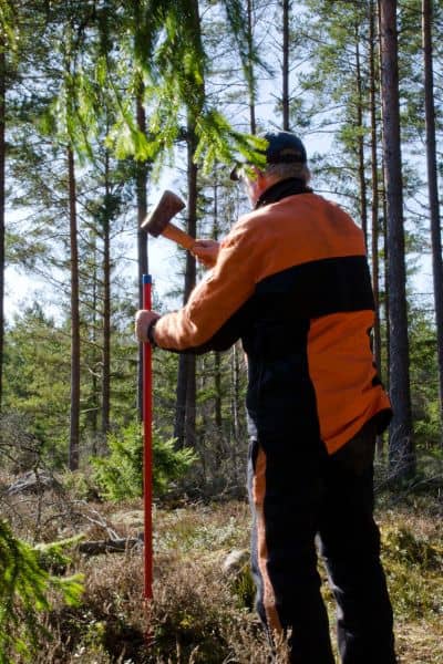
If you’ve never had a boundary line survey done, it might sound complicated. It’s really not. Here’s how it usually goes: first, the surveyor checks out old records — plats, deeds, even old surveys — to understand what they’re working with. Then they head out to your property with high-tech gear to take fresh measurements.
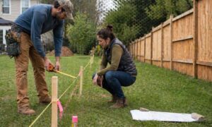
After that, they mark the boundaries on your land. Sometimes that means stakes or flags you can see in the ground. Finally, you’ll get a professional drawing that lays it all out — your lot lines, corners, and dimensions, crystal clear.
Depending on the size of your lot, the whole process can take anywhere from a few days to a couple of weeks. And while the cost varies, most homeowners find it’s a small price to pay compared to the thousands it can save down the road.
The Payoff
So, what do you really gain from a boundary line survey? Peace of mind, for one. You’ll know exactly where your project belongs, and you’ll avoid the stress of disputes or legal battles. It also protects your investment. No one wants to pour money into a new addition or backyard upgrade only to rip it out later.
There’s also the long-term value. If you plan to sell, having a recent survey makes your property more attractive. Buyers love certainty, and you’ll look prepared and professional with that documentation in hand.
And let’s not forget about local rules. Cities like Nashville have zoning laws and setback requirements. A survey makes sure your plans meet those standards from the start, so you don’t get blindsided during permitting.
Choosing the Right Surveyor
Don’t just hire the first name you find. You want a licensed professional who knows the ins and outs of your area. Ask about their experience, especially with residential projects. Look up reviews to see what other homeowners say. And don’t be shy about asking them to explain the process — a good surveyor will walk you through it without all the jargon.
A Nashville Story That Could’ve Been Avoided
Here’s one that happens more than you’d think. A family in East Nashville built a fence where they assumed the line was. A year later, their neighbor produced documents showing the fence was actually on his property. The family had to pay to tear it down and start over.
If they’d ordered a boundary line survey from the start, they would’ve avoided the cost, the stress, and probably some awkward neighborly conversations too.
Final Thoughts
At the end of the day, a boundary line survey is about confidence. Whether you’re building, buying, or just curious about your property, it gives you certainty in a world where guesswork can get expensive fast.
In growing cities like Nashville — or really anywhere land is at a premium — every inch counts. Don’t leave it to chance. Get the facts, mark your lines, and then build your project with peace of mind.
Because the truth is, it’s not just about fences or driveways. It’s about protecting your investment, your home, and your sanity.