When the recent ice storm hit Nashville, most people focused on power outages, blocked roads, and frozen pipes. However, for builders, property owners, and developers, the storm showed something deeper. It exposed which sites were truly prepared — and which ones were not. In other words, the storm worked like a real-world stress test. It pushed roads, utilities, drainage systems, and access routes to their limits. Because of that, many people now see why modern land development services matter more than ever — not just for permits and plans, but for protection and long-term performance.
The Storm Turned Every Site Into a Test Lab
Normally, a site looks fine on a sunny day. Trucks move easily. Water drains without trouble. Utilities work without interruption. But during the ice storm, conditions changed fast.
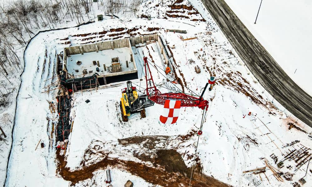
Suddenly, slopes became hazards. Low spots filled with water and then froze. Access drives turned into skating rinks. Some sites became unreachable.
As a result, many owners realized something important: basic site approval does not equal site readiness.
Modern land development services now look beyond “can we build here?” Instead, they ask, “will this site still function under stress?” That shift changes how smart projects start.
Utility Weak Points Became Very Clear
During the storm, many areas lost power for long periods. That created more than comfort problems. It created project risk.
For example, sites with single-source power feeds went dark with no backup path. Pump systems stopped. Heated spaces froze. Some active job sites had to shut down completely.
Because of this, developers now pay closer attention to utility layout during early planning. Strong land development services teams check:
- Where power feeds come from
- Whether backup routing exists
- How exposed lines and equipment sit
- How water service reaches the site
Therefore, utility review should happen early — not after design finishes. That one step alone can prevent long delays later.
Drainage Problems Show Up Fast in Freeze Events
Water always tells the truth about a site. Ice tells it even louder.
During the storm, poor drainage stood out right away. Meltwater flowed into the wrong places. Then it froze overnight. That created slip hazards, pavement damage, and foundation risk.
Meanwhile, well-graded sites performed much better. Water moved away from structures. Surfaces stayed more stable. Access points remained usable longer.
So what does this mean for future projects?
It means grading and drainage design should never feel like “just a permit step.” Instead, they act as protection systems. Good land development services include detailed grading plans, runoff paths, and stormwater controls that work in bad weather — not just average weather.
Access Routes Matter More Than Most Owners Think
At first glance, access seems simple. A driveway connects the road to the site. Problem solved — right?
Not always.
During the ice storm, steep entrances became unusable. Narrow access points blocked emergency and repair vehicles. Construction deliveries stopped. Crews could not enter safely.
Because of that, many property owners now understand that access design needs more thought. Modern land development services review:
- Drive slope and length
- Turn radius for trucks
- Emergency vehicle reach
- Surface materials and traction
- Secondary entry options
In addition, smart planners test access under worst-case conditions. That approach protects both timelines and safety.
Soil and Surface Choices Also Played a Role
Not all ground behaves the same in freezing weather. Some soils hold water near the surface. Others drain better. Some surfaces crack quickly under freeze-thaw cycles.
During the storm, weak subgrade areas showed early damage. Pavement sections failed faster. Temporary surfaces broke down.
Therefore, soil review and surface design deserve more attention than many people give them. Strong land development services include soil data, compaction guidance, and base design that match local conditions — not generic standards.
That detail reduces future repair costs and keeps sites usable longer.
Smart Developers Now Plan for Extremes — Not Averages
In the past, many projects planned around “normal” weather. Today, that approach no longer works well.
Instead, forward-thinking teams now plan for extremes. They ask tougher questions upfront:
What happens if power goes out for days? Where does meltwater go during a freeze? Can emergency vehicles still enter? Will drainage controls still function under ice load?
Because of recent storms, more clients now request resilience reviews as part of land development services. They want stress-tested plans — not just approved drawings.
As a result, early planning has become more valuable than late fixes.
What Property Owners and Developers Should Do Now

If you plan a project in or around Nashville, you don’t need to fear storms. However, you should plan for them.
Start with stronger early evaluation. Work with professionals who review the full picture — utilities, grading, drainage, access, and soil — together, not in isolation.
Also, ask practical questions during planning:
How will water move across the site in winter? What utility risks exist here? Can trucks enter safely during bad weather? Where are the weak points under freeze conditions?
Good land development services answer these questions before construction begins. That timing makes all the difference.
The Big Takeaway
The Nashville ice storm did more than disrupt daily life. It revealed which sites had strong planning and which ones relied on luck.
Above all, it showed that modern land development services now serve a bigger role. They do more than help projects get approved. They help projects survive real-world stress.
So if you plan to build, develop, or invest, treat site planning like risk planning. Because when the next extreme event hits, preparation — not paperwork — will decide how your site performs.