Most people trust GPS without thinking twice. Your phone shows a blue dot. Your car map gives directions. Everything seems steady and exact. However, in the commercial construction world, positioning must be far more precise than a phone map. A few inches off can create real problems. Recently, solar storm alerts and space weather news have gone viral. People talk about auroras and satellite disruption. That sounds exciting — but it also connects directly to land surveying accuracy. Because of that, a commercial property surveyor does not treat satellite positioning as perfect every day. Instead, they add extra GNSS checks when solar activity increases.
Solar Storm Alerts Are Not Just Science News
Solar storms happen when the sun releases bursts of energy and charged particles. These bursts travel toward Earth and disturb the upper atmosphere. As a result, satellite signals can bend, slow down, or scatter slightly.
GNSS — the system behind GPS positioning — depends on stable signal travel from satellites to receivers on the ground. When the atmosphere shifts, those signals shift too.
For everyday navigation, the difference may not matter. However, commercial surveying does not allow guesswork. Building corners, setback lines, and utility locations must land exactly where the plans say they should.
Therefore, when solar storm alerts rise, positioning risk rises too.
Why Commercial Survey Work Feels the Impact Faster
Not all positioning tasks carry the same risk. A hiking app can drift a few feet without harm. A building foundation cannot.
A commercial property surveyor uses GNSS for:
- site control points
- boundary verification
- construction layout
- utility mapping
- as-built documentation
Each of those tasks supports design, permits, financing, and construction. So when positioning shifts even slightly, downstream work suffers.
For example, a mislocated control point can shift curb lines, column grids, or utility offsets. Then crews must restake. Contractors lose time. Owners lose money. Disputes start.
Because of that risk, professionals increase verification when solar conditions look unstable.
GNSS Is Powerful — But Professionals Never Trust One Shot
Modern GNSS equipment works very well. Still, a skilled commercial property surveyor never relies on a single reading. Good surveying always uses confirmation and comparison.
Think of it like accounting. You would not approve a major payment from one rough number. You would check totals, compare records, and confirm sources. Survey control works the same way.
Under calm space weather, crews already run checks. During solar storm alerts, they simply tighten those checks.
That step separates professional surveying from quick positioning.
What Extra GNSS Checks Actually Look Like in the Field
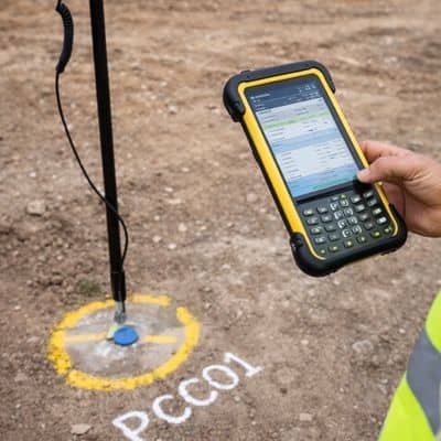
Extra checks do not mean guesswork. They mean structure and discipline. When solar activity increases, survey crews adjust their workflow.
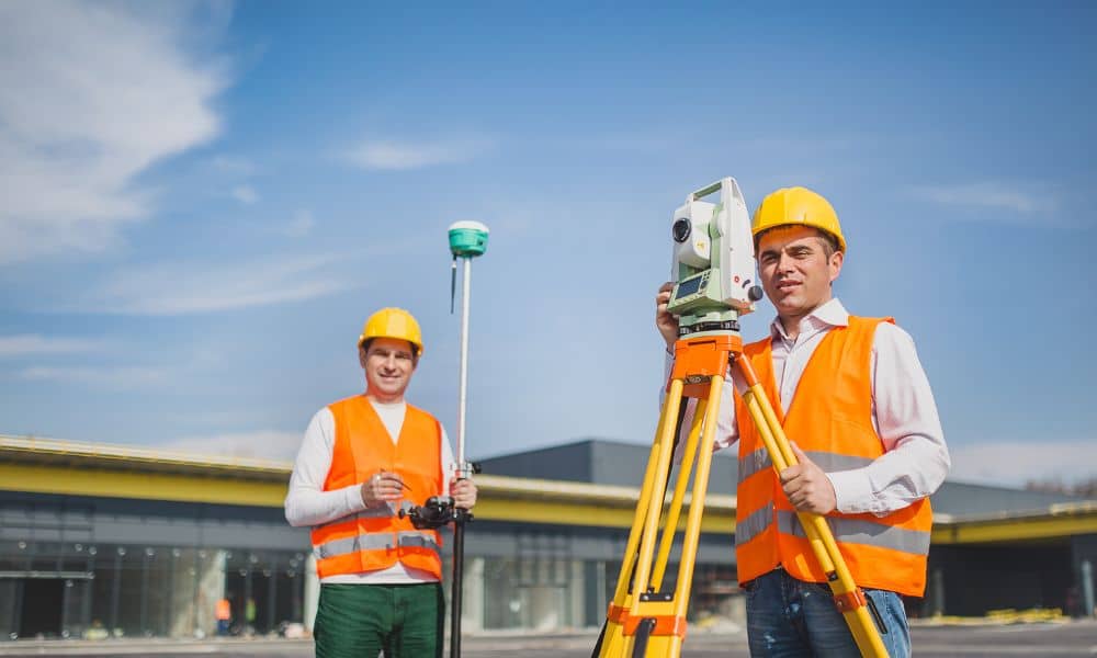
For instance, they may take repeated observations at different times instead of one quick fix. They compare positions across multiple sessions. If results disagree, they keep measuring until values align.
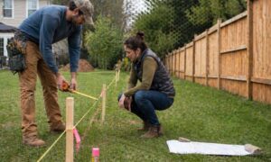
They also tie GNSS points to ground measurements using total stations. Optical instruments do not depend on satellite signals. Therefore, they provide a strong comparison source.
In addition, crews verify against known control points whenever possible. They close measurement loops and confirm that math balances. If numbers drift, they investigate before approving any control.
All of those steps protect your layout accuracy.
Why Commercial Sites Need Tighter Accuracy Than People Expect
Many owners assume small position errors stay small. In reality, small errors grow fast on commercial sites.
Large parcels stretch measurements over long distances. Tight zoning setbacks leave little room for drift. Utility corridors run close to planned structures. Multi-building sites stack layout dependencies.
So a small control shift can multiply across the site.
For example, a two-inch control error can push a building corner out of a setback. That single shift can trigger redesign, variance requests, or field changes. Consequently, what looked minor became expensive.
Because of that, a commercial property surveyor treats control verification as risk management, not extra work.
This Is Not Delay — This Is Protection
Some clients worry when survey crews spend more time checking control. They wonder why staking does not happen immediately. However, faster does not mean safer.
Extra GNSS checks during solar storm alerts protect the schedule instead of hurting it. They reduce the chance of restaking, redesign, and contractor conflict later.
In other words, a careful morning prevents a costly month.
Professional surveyors plan for variable conditions. They watch quality indicators in their equipment. They monitor fix status, residuals, and solution stability. When those indicators look weak, they do not force acceptance. They verify instead.
That discipline keeps your project stable.
What You Should Ask Your Commercial Property Surveyor
If your project depends on precise layout — and most commercial projects do — you should ask a few smart questions.
Ask how control points get verified. Ask whether crews run repeat observations. Ask how they confirm GNSS results with ground measurements. Also ask what happens when satellite conditions look poor.
A strong commercial property surveyor will answer clearly. They will describe redundancy, not shortcuts. They will explain checks, not guesses.
That conversation builds trust and sets expectations early.
Space Weather Trends Come and Go — Verification Always Matters
Solar storm news will trend again. Social media will show sky photos and satellite stories. Meanwhile, professional survey crews will keep doing something less flashy but more important.
They will verify.
A commercial property surveyor understands that satellite positioning, while powerful, still lives inside real-world physics. Signals change. Conditions shift. Accuracy requires confirmation.
Therefore, extra GNSS checks during solar storm alerts do not signal fear. They show professionalism.
And when your building corners, utility lines, and control points land exactly where they should, you will feel glad someone took that extra step.